Physical Address
304 North Cardinal St.
Dorchester Center, MA 02124
Physical Address
304 North Cardinal St.
Dorchester Center, MA 02124
Compare the top commercial drone LiDAR payloads for 2026: DJI Zenmuse L2, YellowScan Surveyor Ultra & Voyager, and Riegl VUX-series. Find the best for your surveying needs.
The precision and efficiency of drone-based Light Detection and Ranging (LiDAR) technology have revolutionized industries from surveying and mapping to infrastructure inspection and environmental monitoring. As of September 2026, the market offers an increasingly sophisticated array of LiDAR payloads, designed to integrate with various drone platforms and deliver survey-grade data. Choosing the right payload is critical for achieving the desired accuracy, range, and data density for your specific project needs.
This comparison focuses on three leading contenders in the commercial drone LiDAR payload market: DJI, YellowScan, and Riegl. We will delve into their latest offerings, comparing specifications, performance, and suitability for different professional applications. Understanding the nuances between these brands will empower you to make an informed decision, ensuring your investment in drone LiDAR technology yields maximum returns.
| Feature | DJI Zenmuse L2 | YellowScan Surveyor Ultra | Riegl VUX-120/240 Series |
|---|---|---|---|
| Weight | ~750g | ~1.2kg (Sensor only) | ~2.6kg – ~4.5kg (depending on model) |
| Range (Max) | ~450m (@80% reflectivity) | ~540m | Up to 1,500m (VUX-120) / 3,000m (VUX-240) |
| Laser Wavelength | 1550 nm | 1550 nm | 1550 nm |
| Returns/Echoes | Up to 5 | Up to 3 | Up to 10 (VUX-120) / 32 (VUX-240) |
| Positioning/IMU | Integrated GNSS IMU | Integrated GNSS IMU | High-performance GNSS IMU (optional) |
| Typical Price Range | $9,000 – $12,000 (Payload only) | $50,000 – $70,000 (System including drone integration support) | $80,000 – $200,000+ (Depending on configuration and drone) |
| Ideal Use Cases | Entry-level surveying, photogrammetry enhancement, small to medium-sized projects | Medium to large-scale surveying, forestry, corridor mapping, mining | Large-scale mapping, complex terrain, long-range scanning, high-density point clouds |
| Pros | Lightweight, integrated with DJI ecosystem, accessible price point, user-friendly | Robust design, excellent data quality, modular for different drones, dedicated support | Industry-leading range and accuracy, high point density, versatility, proven reliability for demanding applications |
| Cons | Limited range and penetration compared to high-end systems, not ideal for extremely dense vegetation or very long-range missions | Higher cost than DJI, can require more complex integration with non-standard drones | Highest cost, heaviest payloads, requires high-lift drones, steeper learning curve |
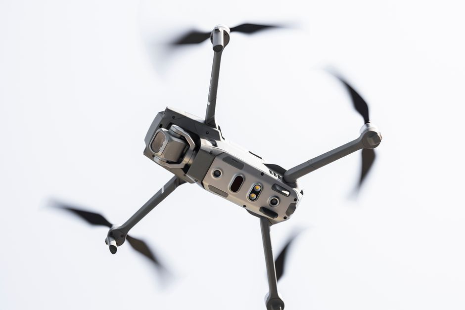
The DJI Zenmuse L2, released in late 2025, represents DJI’s continued commitment to integrating high-performance LiDAR directly into its professional drone platforms. This payload is designed to be a significant upgrade over previous generations, offering enhanced capabilities for professionals looking for an accessible entry into survey-grade mapping.
Key specifications include a maximum range of approximately 450 meters at 80% reflectivity, a 1550 nm laser, and the ability to capture up to five returns per pulse. This allows for better penetration through foliage than simpler LiDAR systems, crucial for applications like forestry and terrain modeling under canopy. Its relatively light weight, around 750 grams, makes it compatible with a range of DJI’s professional drones, most notably the Matrice 350 RTK.
The Zenmuse L2 benefits from DJI’s integrated ecosystem. It features a built-in high-precision IMU and GNSS receiver, simplifying setup and calibration. The accompanying DJI Terra software streamlines data processing, making it an attractive option for organizations new to LiDAR or those already invested in DJI’s workflow. As of September 2026, the Zenmuse L2 payload alone is typically priced between $9,000 and $12,000, positioning it as a cost-effective solution for many professional surveying and mapping tasks, especially for small to medium-sized projects or as a supplementary tool for photogrammetry-enhanced surveys.
YellowScan has established itself as a premier provider of high-performance, rugged LiDAR solutions for professional mapping. The Surveyor Ultra, a flagship offering in 2026, is designed for demanding applications where accuracy and efficiency are paramount.
This system boasts a maximum range of around 540 meters and utilizes a 1550 nm laser. A key advantage is its ability to process up to three echoes per laser pulse, offering excellent data penetration through vegetation for detailed forest inventory and topographical surveys. The Surveyor Ultra is engineered for reliability and ease of use, often featuring an integrated GNSS-RTK receiver and IMU for precise positioning without extensive post-processing.
While the sensor itself weighs approximately 1.2 kg, YellowScan offers integration support for a wide array of professional drones, including platforms like the Inspired Flight IF1200A, which are capable of carrying heavier payloads for extended flight times. The price point for the Surveyor Ultra system, including necessary integration and software, typically ranges from $50,000 to $70,000. This positions it as a mid-to-high tier solution, ideal for medium to large-scale projects in sectors such as civil engineering, environmental science, and resource management.
Riegl is synonymous with cutting-edge LiDAR technology, consistently pushing the boundaries of range, accuracy, and data acquisition speed. The VUX-120 and VUX-240 scanners represent the pinnacle of airborne LiDAR, offering unparalleled performance for the most challenging applications.
The VUX-120 features a range of up to 1,500 meters, while the VUX-240 extends this to an astounding 3,000 meters. Both scanners operate in the 1550 nm wavelength and can capture an impressive number of echoes â up to 10 for the VUX-120 and an industry-leading 32 for the VUX-240. This exceptional echo capability ensures maximum data capture, even in extremely dense and complex environments like tropical rainforests or urban canyons.
These systems are designed for integration with high-lift, professional-grade drones such as the Freefly Alta X Gen2 or specialized fixed-wing platforms. While Riegl offers robust integration support and powerful processing software (RIEGL software suite), the system requires a significant investment and a higher level of technical expertise. The weight of these scanners ranges from approximately 2.6 kg to 4.5 kg. Pricing is at the premium end, starting from $80,000 and easily exceeding $200,000 depending on the specific model, IMU/GNSS configuration, and integration requirements. They are the go-to choice for large-scale national mapping projects, challenging geological surveys, and any application demanding the absolute highest point cloud density and accuracy.
Selecting the best commercial drone LiDAR payload in 2026 depends heavily on your specific operational needs, budget, and existing drone infrastructure. Consider the following factors:
Project Scale and Complexity: For small to medium projects, urban mapping, or augmenting photogrammetry, the DJI Zenmuse L2 offers an excellent balance of performance and cost. For larger areas, extensive forestry, or corridor mapping, the YellowScan Surveyor Ultra provides a significant step up in range and data quality.
Vegetation Penetration Requirements: If your work involves dense forest canopies or challenging terrain where multiple returns are crucial for accurate ground modeling, the YellowScan Surveyor Ultra’s three echoes or Riegl’s multi-echo capabilities are essential. The Zenmuse L2’s five returns are an improvement but may still be limiting in the densest environments.
Range and Accuracy Needs: For applications requiring very long-range scanning or extremely high point density for detailed infrastructure or terrain analysis, Riegl remains the undisputed leader. Their VUX series scanners offer unparalleled performance metrics for the most demanding tasks.
Drone Platform and Payload Capacity: Ensure your current or planned drone can adequately support the weight and power requirements of the chosen payload. Lighter payloads like the Zenmuse L2 are compatible with a wider range of DJI drones. Heavier systems like Riegl require high-lift drones, often multirotor or fixed-wing platforms specifically designed for heavy sensor integration.
Budget and Return on Investment (ROI): The DJI Zenmuse L2 is the most budget-friendly entry point, offering significant value. YellowScan represents a mid-range investment for enhanced capabilities, while Riegl is a premium investment for applications where absolute top-tier performance justifies the cost.
Software and Workflow Integration: Consider how the LiDAR data will be processed. DJI offers a streamlined workflow with DJI Terra. YellowScan and Riegl typically come with their own powerful software suites, and integration with third-party processing software is also a key consideration.
The DJI Zenmuse L2’s ability to capture up to five returns per pulse offers improved performance for vegetation penetration compared to basic LiDAR. It can provide valuable data for forest height and density estimations. However, for extremely dense or multi-layered forest canopies where detailed understory mapping is critical, systems like the YellowScan Surveyor Ultra or Riegl VUX series, with their advanced echo processing, may provide superior results.
YellowScan payloads, such as the Surveyor Ultra, are purpose-built, ruggedized LiDAR systems designed for demanding survey applications. They often offer longer range, higher point density capabilities, and more robust vegetation penetration (up to 3 echoes per pulse) than the Zenmuse L2. YellowScan also provides dedicated integration support across a wider variety of drone platforms beyond DJI’s ecosystem and is renowned for its system reliability and data quality in professional surveying contexts.
For routine construction site surveys focused on progress monitoring, earthwork calculations, or as-built verification, a Riegl scanner might indeed be overkill in terms of capability and cost. A DJI Zenmuse L2 or YellowScan Surveyor Ultra could provide sufficient data density and accuracy for most construction applications, offering a more cost-effective solution. Riegl systems are typically reserved for large-scale infrastructure projects, complex terrain mapping, or applications where extreme precision and long-range data acquisition are non-negotiable.
The number of echoes a LiDAR system can record per laser pulse directly impacts its ability to penetrate vegetation and capture detailed ground surfaces. A single echo system might only register the top of the canopy. Multiple echoes (e.g., 3, 5, 10, or 32) allow the laser pulse to reflect off multiple surfaces as it travels back to the sensor. This means a system with more echoes can capture the top canopy, intermediate branches, and ultimately, the bare earth beneath, leading to more accurate digital terrain models (DTMs) in vegetated areas.
As of September 2026, the landscape of commercial drone LiDAR payloads offers excellent options tailored to different professional needs. For organizations seeking an accessible, user-friendly, and cost-effective entry into drone-based LiDAR surveying, the **DJI Zenmuse L2** is the standout choice. It offers a compelling blend of performance, integration, and affordability, particularly for users already within the DJI ecosystem.
However, for professionals requiring higher accuracy, greater range, and superior performance in challenging environments, especially with dense vegetation, the **YellowScan Surveyor Ultra** presents a robust and reliable solution. It strikes an excellent balance between advanced capabilities and practical implementation for medium to large-scale projects.
For applications demanding the absolute pinnacle of performance â maximum range, unparalleled point density, and the ability to penetrate the most challenging environments â **Riegl’s VUX-120/240 series** remains the industry benchmark. While representing the highest investment, these systems deliver unmatched data quality and are indispensable for large-scale national mapping, complex scientific research, and critical infrastructure projects where compromise is not an option.
Therefore, the “best” payload is subjective and depends on your specific mission requirements. For the broadest appeal and best value for many professional use cases, the YellowScan Surveyor Ultra edges out the competition by offering a significant performance upgrade over entry-level systems without the extreme cost and integration demands of the highest-end Riegl scanners. It represents the sweet spot for many serious surveying and mapping operations in 2026.
Prices and features mentioned are accurate as of the date of publication. Always check the official provider website for the most current pricing and availability.